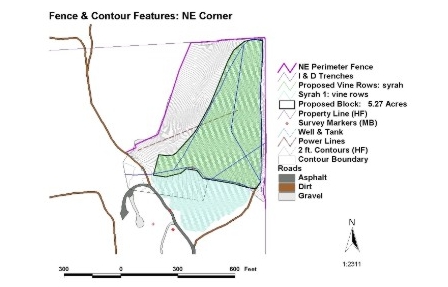
The same preliminary GIS surface model was later used
for coordinating perimeter fencing activities.